The weather cooperated beautifully for the second weekend in May after some chilly, sideways-rain winter days at the start of the month. Our plan had been to get in a run and maybe go to the town about 25 minutes away to use the pool, but the day was just too nice to stay inside. We headed out past Waitomo Village on advice that we would find some great places to stop along the way to the beach at Marokopa. So with full tank of petrol (there are no petrol stations between Otorohanga and the ocean), off we went.
 |
Along the Waitomo Valley Road, which transects the Otorohanga and Waitomo Districts.
There is little sign of the summer drought. |
Our first stop was about 25 km outside Waitomo Village, the Mangapohue Natural Bridge. The road was very winding and fortunately for us this area was well signposted. It just pops up out of nowhere.
 |
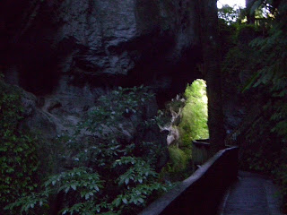
| Just steps from the highway past the carpark the bush is dense. |
 |
| Despite the bright sunshine, the path to the natural bridge was chilly and damp. |
 |
And dark. Ruben is on a viewing platform in this photo. I took many additional photographs, but they were too dark.
There was a couple on the path with us with professional camera gear. I bet they caught some lovely snaps. |
 |
| In this picture you can see both the topside and underside of the bridge. |
 |
| Trees through the underside of the natural bridge. |
 |
| The river running through the underside of the bridge. |
 |
We were attempting to get the bridge behind us. It's there, I promise.
You can see from my jersey that the trees were dripping water on us. |
 |
| The viewing platform on the topside of the bridge. |
We approached the bridge through dense bush, so it was a surprise to cross to the far side and find an expanse of paddock. The footpath directed us this way, so we decided to see where it would take us.
 |
| The far side of the bridge. |
 |
| The path took us to a cluster of big limestone rocks with fossilized oysters visible in the rock. |
After poking around at the rocks, we got back in our Toyota Yaris and continued on our way toward the coast. About 6 km down the road we saw a sign for what was truly a highlight: Marokopa Falls.
 |
| Ruben thought this tree and its roots looked just like a boot. |
We followed a footpath through dense bush for 5 or 10 minutes before we started hearing the roar of the water. From the sound of it, this was going to be a pretty big waterfall. And it certainly was! The water falls 30 meters to the river below. The previous week's rain enhanced our viewing experience, I'm sure.
 |
| Marokopa Falls |
 |
| We climbed down for a closer look, but stopped when the spray coming off the falls changed from pleasant mist to cold shower and the track turned from mud to mud puddle. |
Back in the Yaris, we continued to drive west, toward the town of Marokopa and eventually the ocean. This farmland is simply stunning. These are mostly sheep and dairy farms. We saw several small groups of sheep that had somehow gotten outside their fence. Sheep do not like to be outside their fence. The poor things looked in an absolute panic as they ran back and forth and over each other trying to find a way back in.
 |
It's not unusual to have to stop along the road for cows crossing to another paddock, as we are doing here.
What was unusual here is that there was no farmer in sight.
The cows were just walking themselves across a flattened gate. I reckon that farmer might have a surprise waiting for him or her next milking when the cows aren't where they are supposed to be! |
In addition to the farm country Marokopa has a seaside settlement, which is made up of a cluster of year-round homes, lots of fishing baches, and a camping ground. That's it. If the fishermen don't bring home dinner and it's been a while since the last trip to the grocery store 120 km away, you're in for a hungry night! But what residents here lack in creature comforts like restaurants and petrol stations, they more than make up for with natural wonders like the black sand beach stretching as far as the eye can see and pounding surf.
 |
From a nondescript carpark at the edge of "town" we climbed over a grassy embankment not sure what we'd find.
We found this marvelous beach! |
 |
| The estuary where the Marokopa River meets the Tasman Sea. |
 |
Looking back at the carpark from the beach.
A different world from the hilly farm country we came through to get here! |
 |
Ruben holding a handful of black sand. The tire marks were made by ATVs used by the
fishermen to get to favorite spots. |
 |
| Wide expanse of black sand beach. Even on this cold autumn day the sand was warm to the touch. |
 |
This is a land coral. It looks like a big rock, but there are millions of tiny creatures
in seashells attached to each other and to it. |
 |
| This pic is far away, but there were people using this cave as a shelter. |
 |
| Several families, as well as fishermen, were out enjoying the beach this Mothers' Day. |
 |
| Land corals were great fun for these kids. |
 |
| Again, pretty far away, but the surf past the sandbar was rough! |
 |
| This dog was having a great time fetching sticks. |
 |
| Ruben gave me a ride across the estuary so I wouldn't get my new shoes (thanks, Christine!) wet. |
 |
| Looking at Marokopa settlement from the beach. |
Time to turn inland and drive back to Otorohanga. The sun was threatening to set as we came across this ridge. We stopped to take a few pictures of the Waikato Valley down below.
 |
| In real life we could make out some snow-capped peaks in the distance. |


No comments:
Post a Comment